NONAME


Information related to the vessel NONAME (MMSI 668116315, IMO unknown) from Sao Tome and Principe with latest positions and portcalls.
| MMSI | 668116315 |
| Name | NONAME |
| Country | Sao Tome and Principe |
| MMSI Type | Vessel |
| Type | |
| Class | A |
| Id | 679f5fbe1bc4dc5617826a8c |
| Course | 337.9 |
| Speed (kn) | 0 |
| Heading (°) | 64 |
| PAC | |
| ROT | 0 |
| Status | Moored |

Leaflet | © OpenStreetMap contributors
| First Seen | a month ago |
| Last Update | a month ago |
| Positions | 11 |
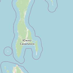
| Latitude | 46.62904666666667 |
| Longitude | 142.76222666666666 |
Distance travelled (nm)
| Since first seen | 29.35 |
| Since last port call | 7.31 |
| Since last position | 0.01 |
Speed (kn) / Draught (m)
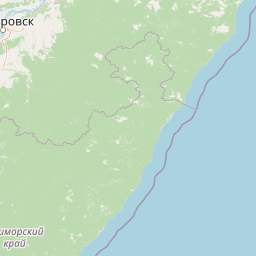
The vessel NONAME (mmsi 668116315) from country Sao Tome and Principe is currently located at 46.629047 N 142.762227 E and the last position is sent a month ago. At the moment the vessel is Moored heading 64 degree at speed 0 knots, and its current draught is unknown meters. The vessel is long unknown m and large unknown m, and it's estimated to be loaded at 0%.
Timeline
The following timeline will display the list of porcalls and other events regarding the ship including tracks.
- 2025-02-02T23:38:39.058Z - 2025-03-10T23:05:52.541Z
Navigation (2 positions)
- 2025-02-02T23:38:39.058Z
Arrival to Prigorodnoye
- 2025-02-02T12:06:22.147Z
First seen
This vessel has been detected for the first time by Oceanook
