NONAME


Information related to the vessel NONAME (MMSI 562446953, IMO unknown) from with latest positions and portcalls.
| MMSI | 562446953 |
| Name | NONAME |
| Country | |
| MMSI Type | Vessel |
| Type | |
| Class | A |
| Id | 67e7877096674d034c7a8479 |
| Course | 242.2 |
| Speed (kn) | 9 |
| Heading (°) | 244 |
| PAC | |
| ROT | 2.8569784533381095 |
| Status | At anchor |
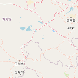

Leaflet | © OpenStreetMap contributors
| First Seen | 4 days ago |
| Last Update | 4 days ago |
| Positions | 1 |
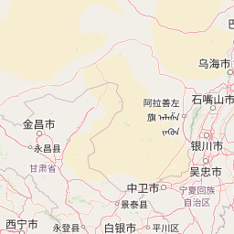
| Latitude | 36.10358333333333 |
| Longitude | 103.97279 |
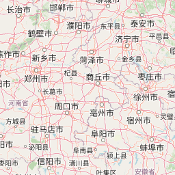
The vessel NONAME (mmsi 562446953) from country is currently located at 36.103583 N 103.972790 E and the last position is sent 4 days ago. At the moment the vessel is At anchor heading 244 degree at speed 9 knots, and its current draught is unknown meters. The vessel is long unknown m and large unknown m, and it's estimated to be loaded at 0%.
Timeline
The following timeline will display the list of porcalls and other events regarding the ship including tracks.
- 2025-03-29T05:38:56.703Z
First seen
This vessel has been detected for the first time by Oceanook
