NONAME
Tug


Information related to the Tug vessel NONAME (MMSI 533160214, IMO unknown) from Malaysia with latest positions and portcalls.
| MMSI | 533160214 |
| Name | NONAME |
| Country | Malaysia |
| MMSI Type | Vessel |
| Type | Tug |
| Call Sign | 9WPH4 |
| Class | A |
| Id | 608f7ce01ecbac459b4f4ae5 |
| Course | 269.3 |
| Speed (kn) | 0.2 |
| Heading (°) | 208 |
| PAC | |
| ROT | 0 |
| Status | Not defined (default) |
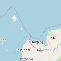

Leaflet | © OpenStreetMap contributors
| First Seen | 4 years ago |
| Last Update | 4 minutes ago |
| Positions | 343 |
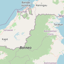
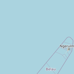
| Latitude | 5.993566666666666 |
| Longitude | 116.07871666666666 |
| Length (m) | 29 |
| Width (m) | 11 |
Distance travelled (nm)
| Since first seen | 7271.29 |
| Since last port call | 7271.29 |
| Since last position | 0 |
Speed (kn) / Draught (m)
The Tug vessel NONAME (mmsi 533160214) from country Malaysia is currently located at 5.993567 N 116.078717 E and the last position is sent 4 minutes ago. At the moment the vessel is Not defined (default) heading 208 degree at speed 0.2 knots, and its current draught is unknown meters. The vessel is long 29 m and large 11 m, and it's estimated to be loaded at 0%.
Timeline
The following timeline will display the list of porcalls and other events regarding the ship including tracks.
- 2021-05-03T04:32:32.337Z
First seen
This vessel has been detected for the first time by Oceanook
