NONAME


Information related to the vessel NONAME (MMSI 494747647, IMO unknown) from with latest positions and portcalls.
| MMSI | 494747647 |
| Name | NONAME |
| Country | |
| MMSI Type | Vessel |
| Type | |
| Class | A |
| Id | 67e71dc496674d034c2cb2f0 |
| Course | 311.9 |
| Speed (kn) | 95.7 |
| Heading (°) | 288 |
| PAC | |
| ROT | -0.04464028833340796 |
| Status | Engaged in Fishing |


Leaflet | © OpenStreetMap contributors
| First Seen | 4 days ago |
| Last Update | 4 days ago |
| Positions | 1 |
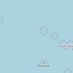
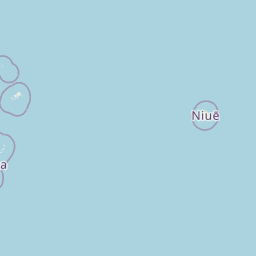
| Latitude | -15.435756666666666 |
| Longitude | -155.34167666666667 |
The vessel NONAME (mmsi 494747647) from country is currently located at -15.435757 S -155.341677 W and the last position is sent 4 days ago. At the moment the vessel is Engaged in Fishing heading 288 degree at speed 95.7 knots, and its current draught is unknown meters. The vessel is long unknown m and large unknown m, and it's estimated to be loaded at 0%.
Timeline
The following timeline will display the list of porcalls and other events regarding the ship including tracks.
- 2025-03-28T22:08:04.338Z
First seen
This vessel has been detected for the first time by Oceanook
