NONAME


Information related to the vessel NONAME (MMSI 345141756, IMO unknown) from Mexico with latest positions and portcalls.
| MMSI | 345141756 |
| Name | NONAME |
| Country | Mexico |
| MMSI Type | Vessel |
| Type | |
| Id | 679f10561bc4dc56174bccd9 |
| Course | 334 |
| Speed (kn) | 0 |
| Heading (°) | 63 |
| PAC | |
| ROT | |
| Status |


Leaflet | © OpenStreetMap contributors
| First Seen | a month ago |
| Last Update | a month ago |
| Positions | 1 |
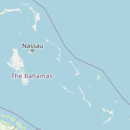
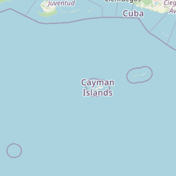
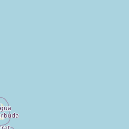
| Latitude | 23.48493 |
| Longitude | -75.73886166666666 |
The vessel NONAME (mmsi 345141756) from country Mexico is currently located at 23.484930 N -75.738862 W and the last position is sent a month ago. At the moment the vessel is heading 63 degree at speed 0 knots, and its current draught is unknown meters. The vessel is long unknown m and large unknown m, and it's estimated to be loaded at 0%.
Timeline
The following timeline will display the list of porcalls and other events regarding the ship including tracks.
- 2025-02-02T06:27:34.993Z
First seen
This vessel has been detected for the first time by Oceanook
