NONAME


Information related to the vessel NONAME (MMSI 244767428, IMO unknown) from Netherlands with latest positions and portcalls.
| MMSI | 244767428 |
| Name | NONAME |
| Country | Netherlands |
| MMSI Type | Vessel |
| Type | |
| Class | A |
| Id | 67e71f8496674d034c2e067b |
| Course | 322.9 |
| Speed (kn) | 0 |
| Heading (°) | 260 |
| PAC | |
| ROT | 0 |
| Status | Under way using engine |


Leaflet | © OpenStreetMap contributors
| First Seen | 4 days ago |
| Last Update | 4 days ago |
| Positions | 1 |
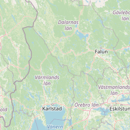
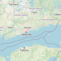
| Latitude | 59.71907 |
| Longitude | 19.069255 |
The vessel NONAME (mmsi 244767428) from country Netherlands is currently located at 59.719070 N 19.069255 E and the last position is sent 4 days ago. At the moment the vessel is Under way using engine heading 260 degree at speed 0 knots, and its current draught is unknown meters. The vessel is long unknown m and large unknown m, and it's estimated to be loaded at 0%.
Timeline
The following timeline will display the list of porcalls and other events regarding the ship including tracks.
- 2025-03-28T22:15:32.677Z
First seen
This vessel has been detected for the first time by Oceanook
