NONAME


Information related to the vessel NONAME (MMSI 767138482, IMO unknown) from with latest positions and portcalls.
| MMSI | 767138482 |
| Name | NONAME |
| Country | |
| MMSI Type | Vessel |
| Type | |
| Class | A |
| Id | 67ef984196674d034c6314fe |
| Course | 38.4 |
| Speed (kn) | 61.2 |
| Heading (°) | 270 |
| PAC | |
| ROT | -330.15957251388534 |
| Status | Aground |


Leaflet | © OpenStreetMap contributors
| First Seen | a month ago |
| Last Update | a month ago |
| Positions | 1 |
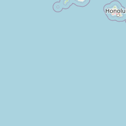
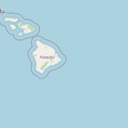
| Latitude | 16.241026666666667 |
| Longitude | -163.930645 |
The vessel NONAME (mmsi 767138482) from country is currently located at 16.241027 N -163.930645 W and the last position is sent a month ago. At the moment the vessel is Aground heading 270 degree at speed 61.2 knots, and its current draught is unknown meters. The vessel is long unknown m and large unknown m, and it's estimated to be loaded at 0%.
Timeline
The following timeline will display the list of porcalls and other events regarding the ship including tracks.
